One of my personal projects is to map out and survey the major rivers in Eastern & Central Kentucky, in particular, their headwaters. Eastern Kentucky is drained by three main rivers; Big Sandy, Licking, and the Cumberland. Each of these rivers runs a course quite distinct from the others, though their headwaters reside within a few dozen miles and all are tributaries of the Ohio. Central Kentucky is in turn drained by the Kentucky River, whose headwaters are also in the same vicinity.
Licking River
The Licking river runs through my hometown of Morehead and beyond forming Cave Run Lake it attracts little attention. It has a powerful flow year round, but few rapids and runs mostly through private farms. Its headwaters are located in Magoffin County in a difficult to access area around route 7. Unlike the others in this project, the Licking River retains the same identity end to end. It does have two “forks”, but these are in name only. Both are simply downstream tributaries, although locals along the South Fork often mistake it to be the main stem. The Licking is personally notorious to me because every time I go near it, mishaps surly follow. One in particular probably should have killed me, but instead just left a minor scar. Sometimes it’s better to be lucky than good. Rivers have a personality, and as I am learning, the Licking doesn’t seem to like me very much. I’ll probably do this one next.
Big Sandy River
Second to the Cumberland in historical significance, the Big Sandy proper is barley 30 miles in length, otherwise divided into Tug Fork and the dangerous Levisa Fork. Because of the distance involved, I will likely save this river for last, and conduct most of the mapping during kayaking trips.
Kentucky River
The Kentucky itself is easily assessable, but its three forks are somewhat dispersed. I plan to take this after finishing up the Licking.
Cumberland River
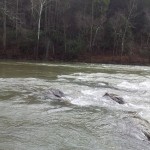
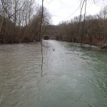
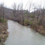
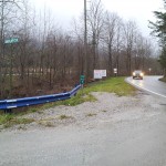
Of these four rivers, the Cumberland is by far the largest, most unique in course, and historically significant. It also has the most physically accessible headwaters areas, though perhaps the most isolated. For these reasons it was my first choice. Like many large rivers, there is some debate to this day what exactly constitutes the Cumberland headwaters. In name the Cumberland begins in Harlan Kentucky, where the Martin’s Fork, Clover Fork, and Poor Fork converge. This spot is quite easily accessible; it literally forms the back boundary of a Dairy Queen parking lot. From a hydrological standpoint, each river contributes about an equal share of water volume, so in effect there really isn’t a single headwaters, not on a human scale anyway – it’s more accurate to say the Cumberland’s source is Harlan County itself.
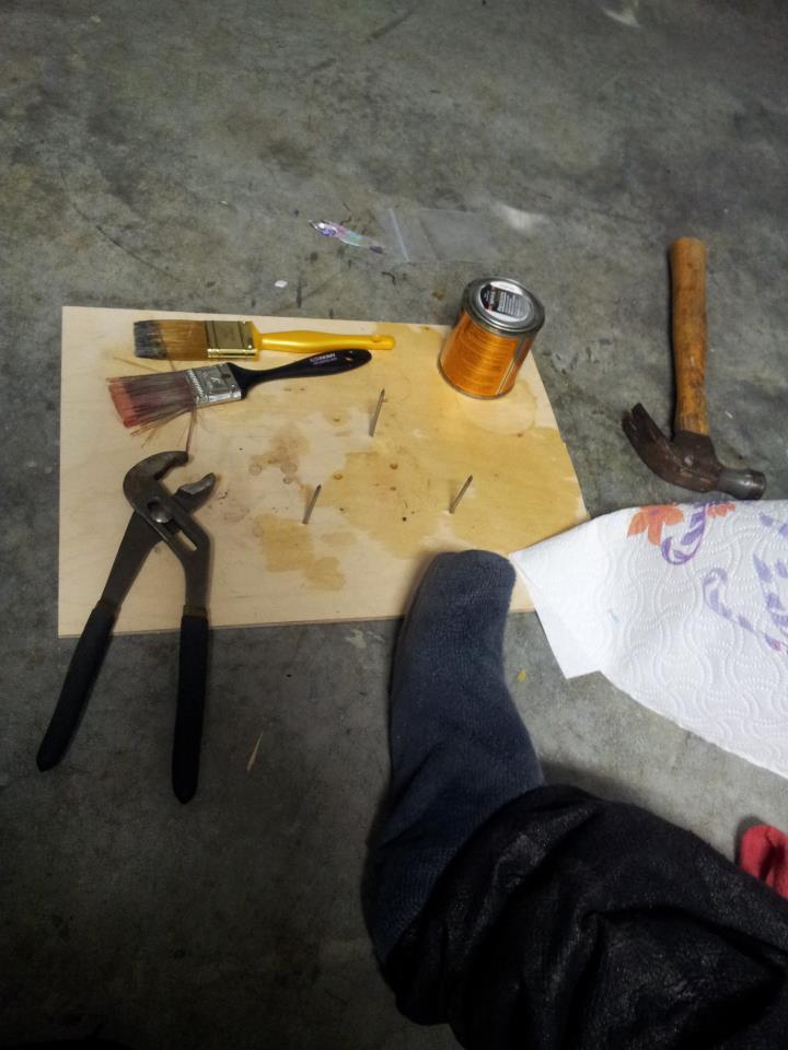
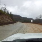
That all said, the very definition of “headwaters” is the most remote source of a given watercourse, even if insignificant by volume. Since the Poor Fork is the longest contributing stream, that means its source is also that of the Cumberland. All there is to be done is trace the Poor Fork until it’s nothing more than a ditch. To do this I left for Harlan KY on 2011/12/27. Apparently I wasn’t supposed to go. Out of the whole week, I picked the one day with blowing rain, sleet and fog. Then I didn’t even make it out of the house before I took a nail through my foot, but if I let that stop me I wouldn’t deserve to lace up my explorer’s gloves. Anyway, the plan was simple enough. Get to the confluence in Harlan, follow Poor Fork to its source, draw out a mental map, and take lots of pictures or video along the way. Naturally there were distractions, but that’s the point of an exploration trip, yes? These are the results:
Success:

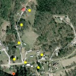
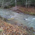
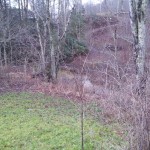
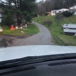
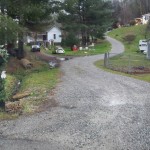
Poor Fork’s ultimate source is a slight bowl shaped depression at the top of Pine Mountain along hwy 932 that collects water from numerous gulleys and puddles into two small streams. These streams converge roadside, forming the Poor Fork, which continues for some 30 miles back to the confluence at Harlan. Both streams are on private property. I was unable to get permission to explore the larger one (no one answered), but the other was in a front lawn and easily photographed. I wonder if the owner has any idea that a mud puddle under his VW Bug is the primary water source for a 680+ mile river that discharges over 225,000 gallons of per second at its terminus. I would like to Map the Martin’s Fork and Clover fork as well, but for now, mission accomplished.
Videos
Checking out the culvert where Watts Creek passes under Highway 119 along Seven Sisters Road in Bell County. Nice scenery at the far end. Also saw an interesting little cave, but it was water filled. I’ll have to come back with swimming gear and underwater lights to have a better look. Part of a personal project to survey the headwaters of Cumberland River.
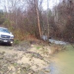
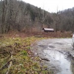
Accidentally left the camera on while scouting this boat ramp access path along the Cumberland River. Figured what the heck and tossed it up.
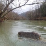
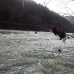
Scouting for a picture, this where Clover, Martin’s and Poor Fork converge to form the Cumberland.
Pictures:
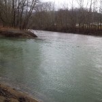
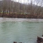
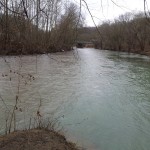
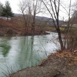
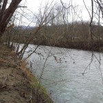
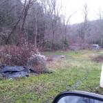
Various pictures taken along the way:


As an author of several river guidebooks, including the Cumberland River, I share your interest in exploring river headwaters. Most rivers are much longer than their named portions and in the natural order of things a river begins at the source as you describe and continue to the mouth. If the Missouri River had only one name from the source to the mouth it would be the longest river in the world.
How true.
Names vs. actual hydrology don’t always coincide. One of my favorites is the Ohio vs. Mississippi. The Ohio carries a larger volume (by quite a margin), and at even at the confluence it is visibly obvious the Mississippi is the tributary stream. I’d be interested to know why that mistake was made; I assume it was for ease of a singular East/West boundary feature for the frontier.
In any case, it’s fun to try and locate the most remote source, even if it really isn’t the main contributor. Hydrology and geography in general have always fascinated me. I would love to have a look at your guides, what are they called?
Thanks for the comment!
DC